

India, a mesmerising world, full of vibrant cultures, traditions and geographies, takes you on a soul stirring journey. It stretches from the snow-capped mountains to the green coastlines, taking you to the depths of spirituality. This entrancing experience is what tourists get when they travel to India. Venture forth and discover this multi-coloured country as it mesmerises you with its raw beauty. And to assist you in this life changing adventure, India travel planner creates an itinerary which incorporates all must visit places, how to reach separately and the best time to visit. Any holiday planned is sure to ensure a lifetime of memories. The wide categories are sure to tempt you to make plans at the earliest.
The Himalyas
Choose Your Next Destination
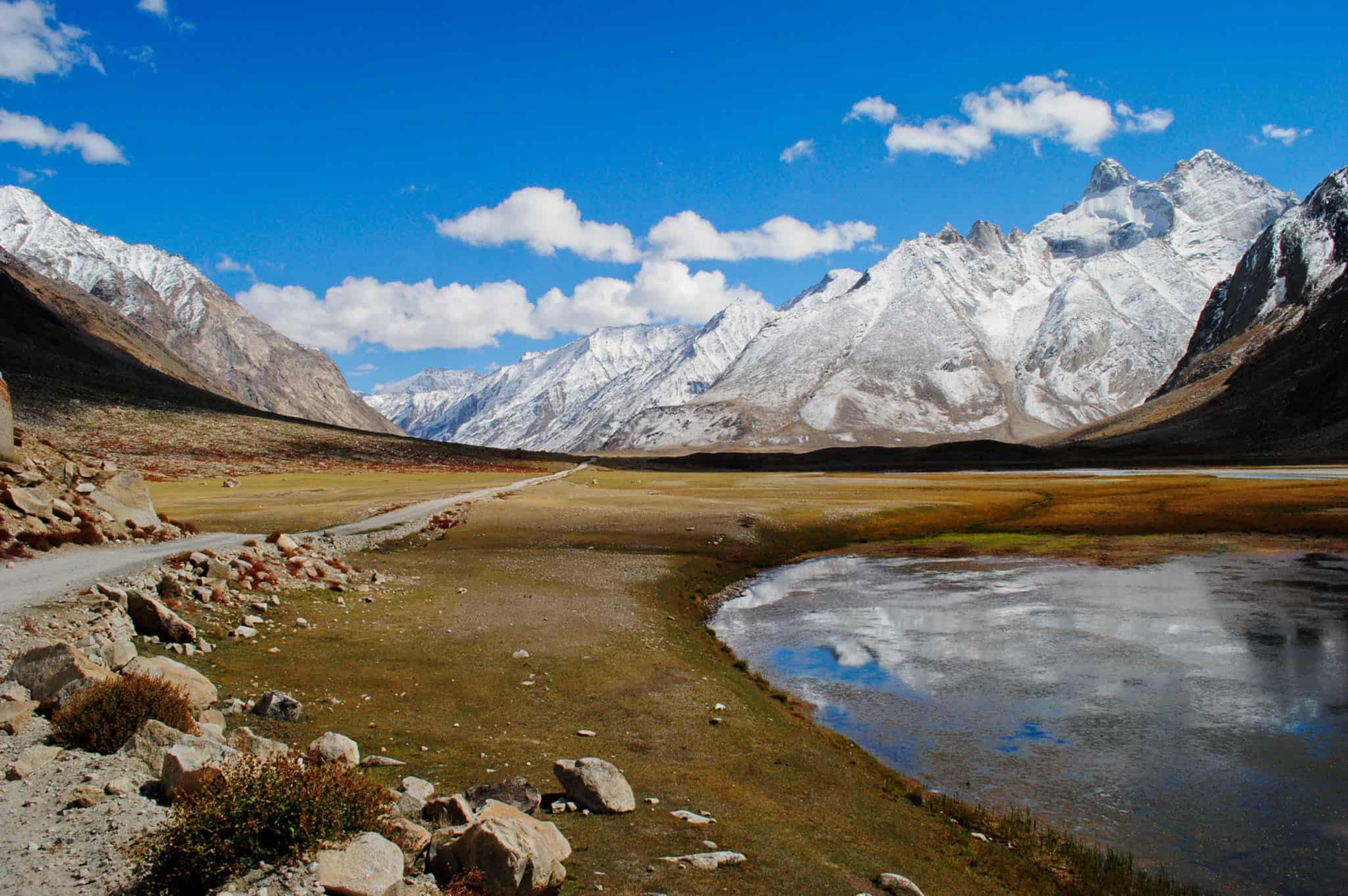
Zanskar Valley, Leh , Jammu & Kashmir
Nearest Airport : Leh Distance from Nearest Airport :105Km Zanskar or Zahar is a subdistrict or tehsil of the Kargil district, which lies in the eastern half of the Indian state of Jammu and Kashmir. The Zanskar Range is part of the Tethys Himalaya, an approximately 100-km-wide synclinorium formed by strongly folded and imbricated, weakly metamorphosed sedimentary series. The average height of the Zanskar Range is about 6,000 m (19,700 ft). Its eastern part is known as Rupshu.
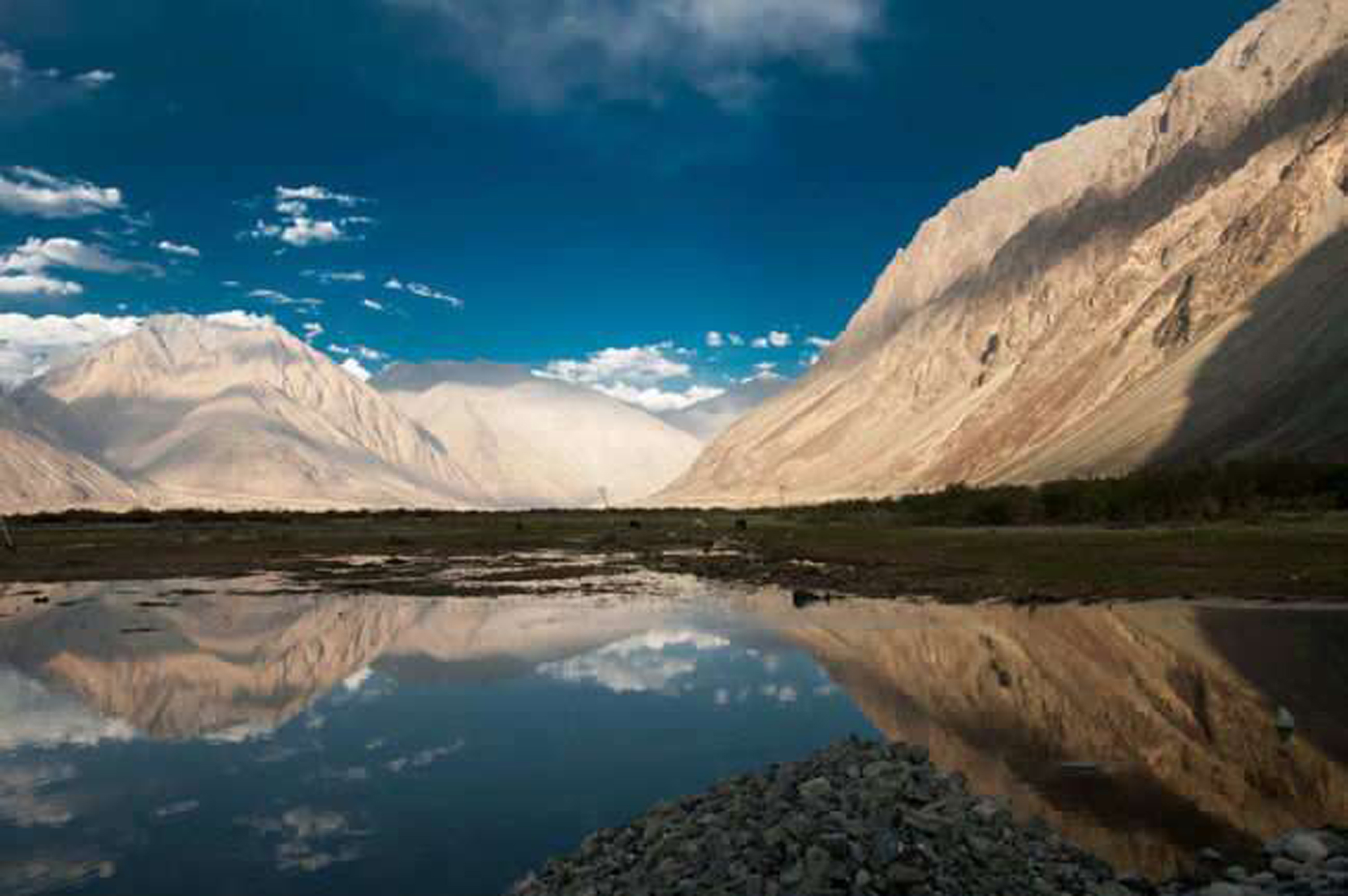
Nubra Valley, Leh , Jammu & Kashmir
Nearest Airport : Leh Distance from Nearest Airport :150Km Nubra is a tri-armed valley located to the north east of Ladakh valley. Diskit the capital of Nubra is about 150 km north from Leh town, the capital of Ladakh district, Jammu and Kashmir, India. Local scholars say that its original name was Ldumra (the valley of flowers). The Shyok River meets the Nubra or Siachan River to form a large valley that separates the Ladakh and Karakoram Ranges. The Shyok river is a tributary of the Indus river. The average altitude of the valley is about 10,000 ft. i.e. 3048 metres above the sea level. The common way to access this valley is to travel over the Khardung La pass from Leh town.
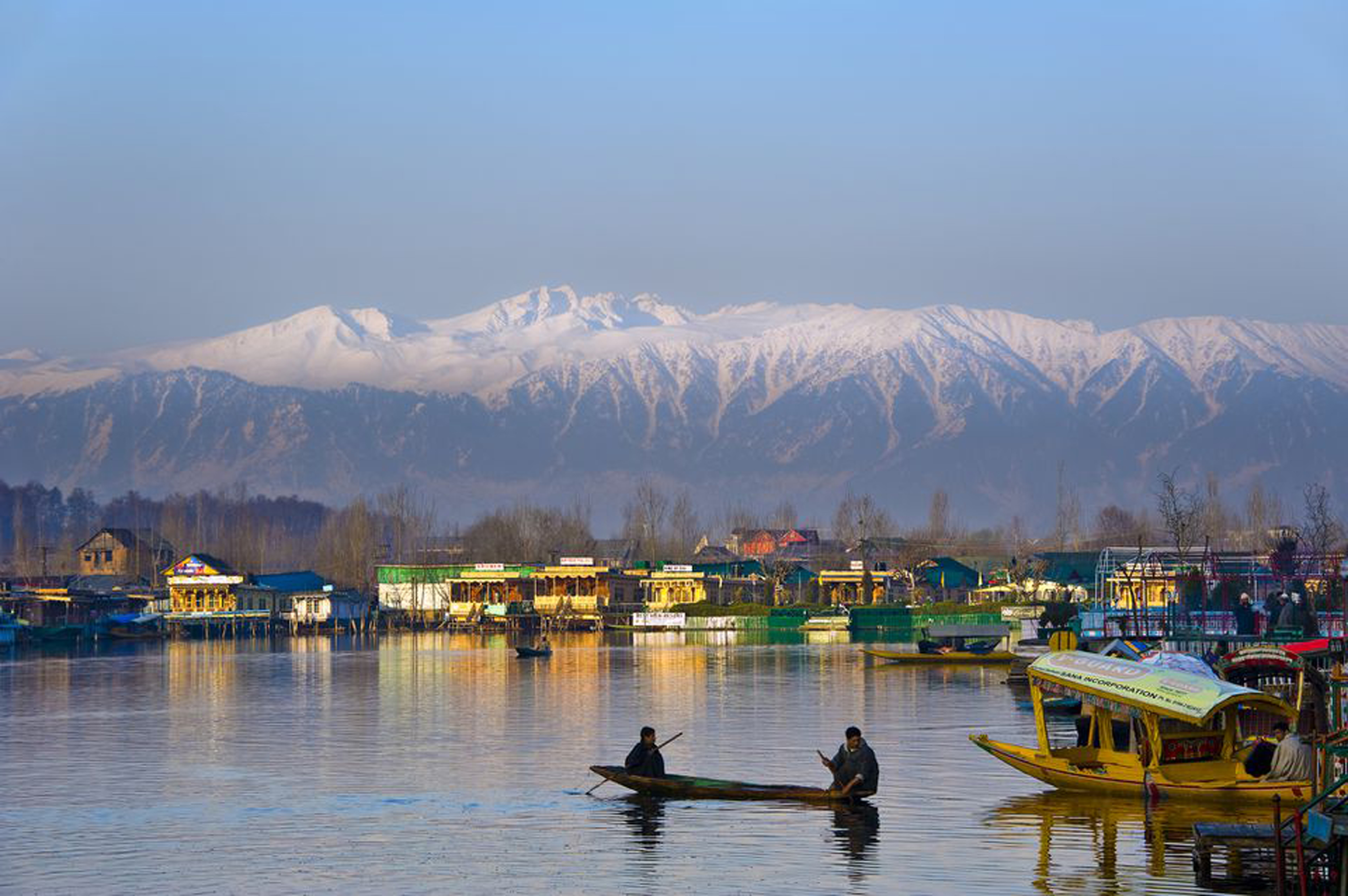
Srinagar, Jammu & Kashmir
Nearest Airport : Srinagar Distance from Nearest Airport :0 Srinagar lies in the Kashmir Valley on the banks of the Jhelum River, a tributary of the Indus, and Dal and Anchar lakes. The city is known for its natural environment, gardens, waterfronts and houseboats.
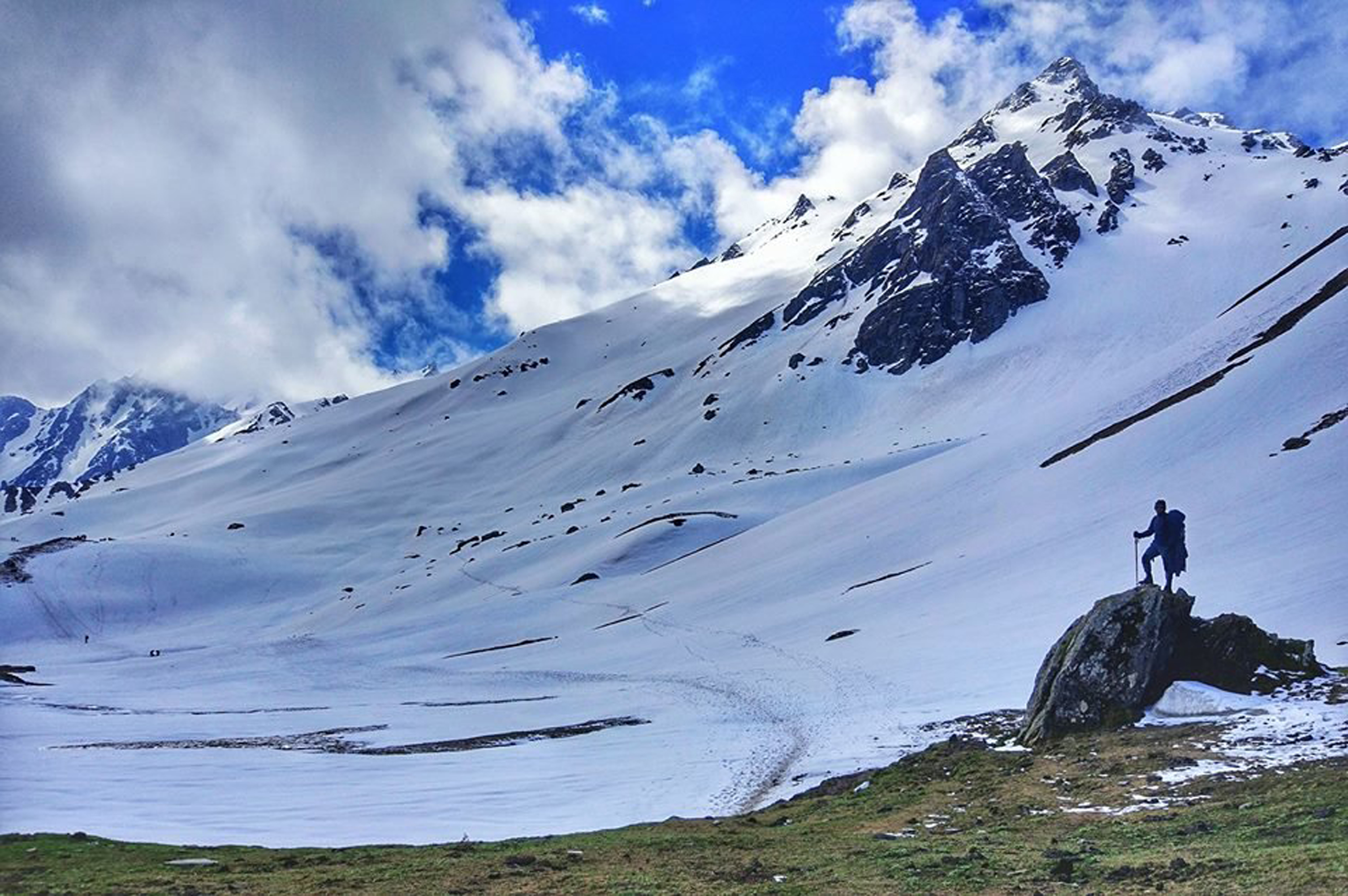
Sar Pass, Kullu, Himachal Pradesh
Nearest Airport : Kullu Distance from Nearest Airport :0 The Sar Pass is in Parvati Valley of Kullu district of Himachal Pradesh, a state of India. Sar, in the local dialect, means a lake. While trekking, across the path from Tila Lotni to Biskeri Ridge, one has to pass by a small, (normally) frozen lake (Sar) and hence the name Sar Pass Trek. The real joy of the trek is the 100ft long snow slides.
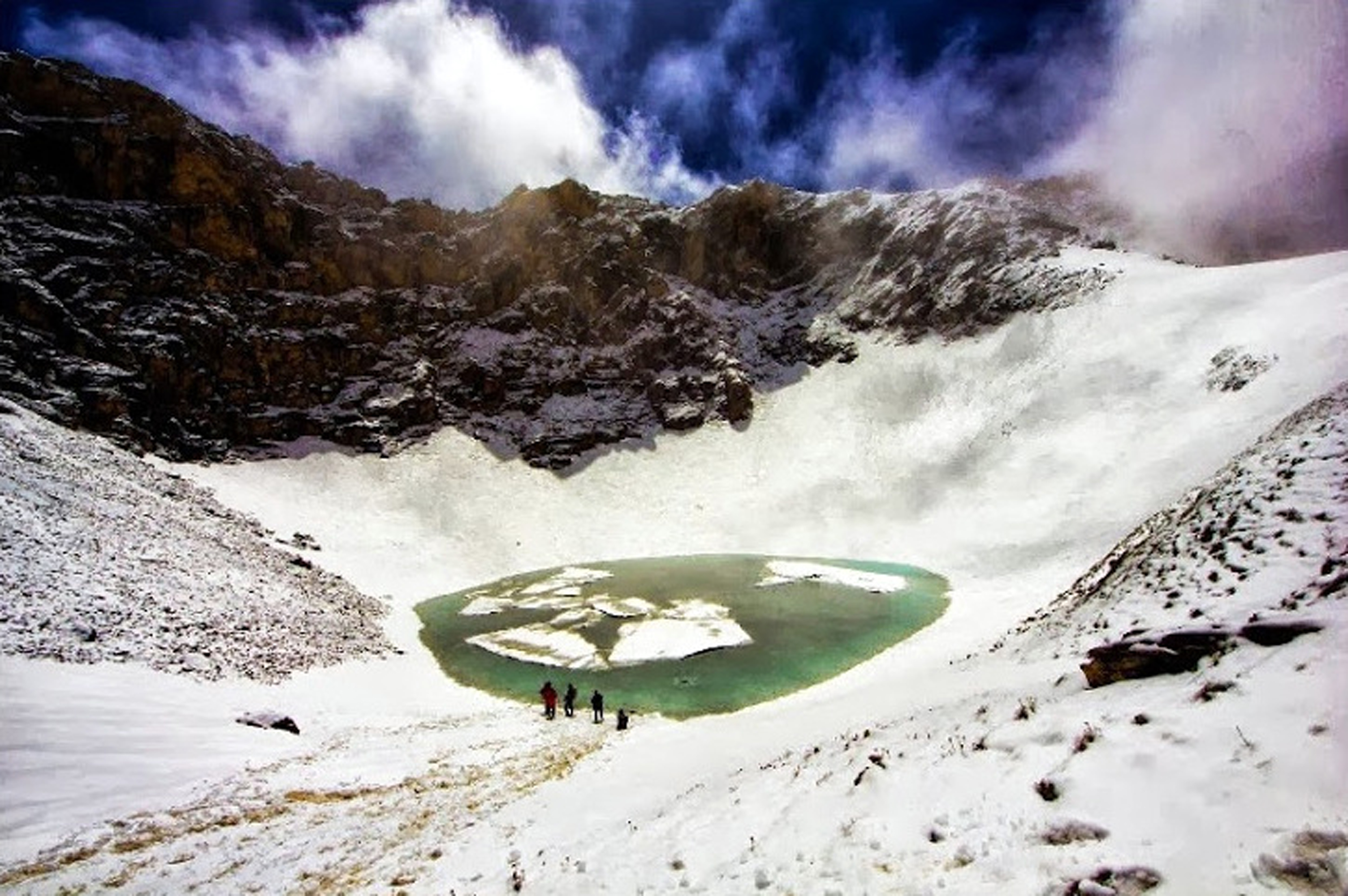
Roopkund, Uttarakhand
Nearest Airport : Dehradun Distance from Nearest Airport : 195km Roopkund is a high altitude glacial lake in the Uttarakhand state of India. It lies in the lap of Trishul massif and is famous for the hundreds of human skeletons found at the edge of the lake. The area is uninhabited, in the Himalayas at an altitude of 5,029 metres (16,499 feet). Surrounded by rock-strewn glaciers and snow-clad mountains, the lake is a popular trekking destination
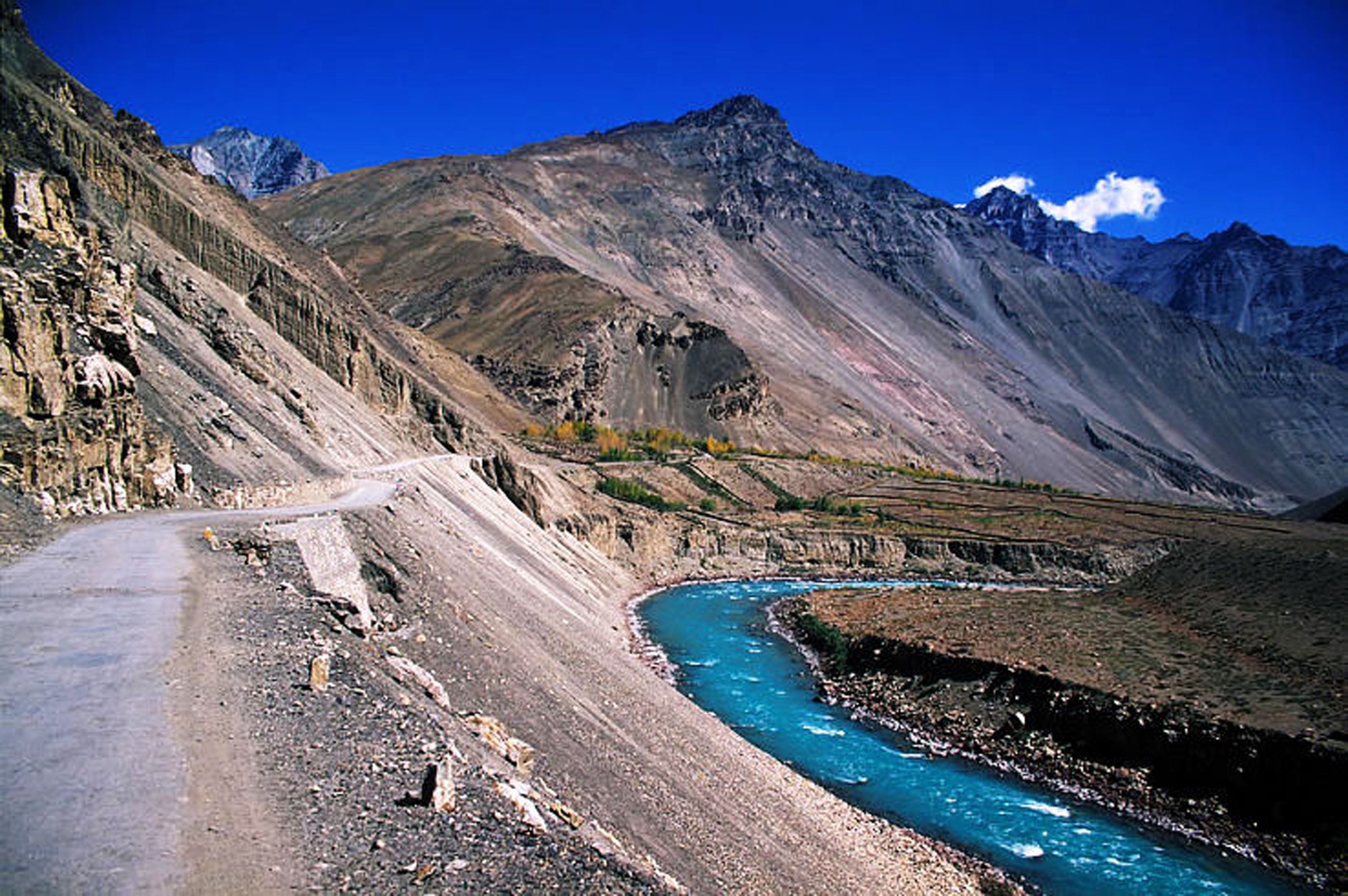
Nako, Tabo & Kaza, Himachal Pradesh
Nearest Airport : Chandigarh Distance from Nearest Airport : 500km Nako is a village in the Himalayas of northern India, located near the Indo-China border in the Trans-Himalayan region of Kinnaur district in Himachal Pradesh. Nako Lake is a prominent feature here where it borders the village. Nako Monastery, dated to 1025, is located in the village as well as several other Buddhist chortens Tabo is a small town in the Lahaul and Spiti district on the banks of the Spiti River in Himachal Pradesh, India. The town lies on the road between Rekong Peo and Kaza (alternative spelling: Kaja), the sub-divisional headquarters of Spiti. The town surrounds a Buddhist monastery which, according to legend, is said to be over a thousand years old. The Dalai Lama has expressed hisdesire to retire to Tabo, since he maintainsthat the Tabo Monastery is one of the holies Kaza is the subdivisional headquarters of the remote Spiti Valley in the western Himalayas in the Lahaul and Spiti district of the northern Indian state of Himachal Pradesh. Spiti is a high altitude or cold desert having close similarities to the neighbouring Tibet and Ladakh regions in terms of terrain, climate and the Buddhist culture. Kaza, situated along the Spiti River at an elevationof 3,650 metres (11,980 ft) above mean sea level, is the largest township and commercial center ofthe Spiti valley
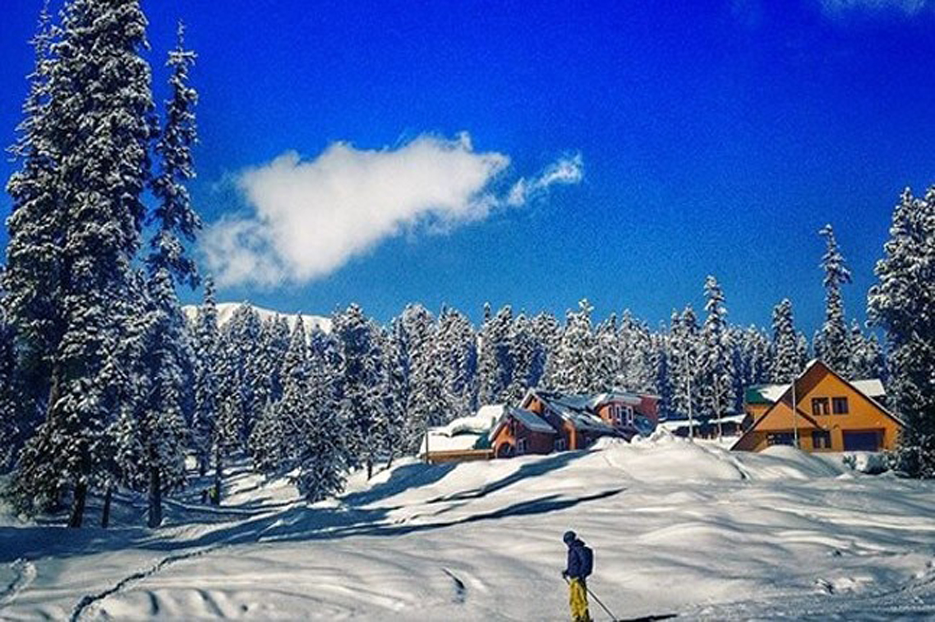
Gulmarg, Jammu & Kashmir
Nearest Airport : Srinagar Distance from Nearest Airport : 90km Gulmarg lies in a cup shaped valley in the Pir Panjal Range of the Himalayas, at an altitude of 2,650 m (8,694 ft), 56 km from Srinagar. The soil in Gulmarg comprises glacial deposits, lacustrine deposits and moraines of Pleistocene age covering shales, limestones, sandstones, schists and other varieties of rocks.The natural meadows of Gulmarg, which are covered with snow in winter, allow the growth of wild flowers such as daisies, forget-me-nots and buttercups during spring and summer
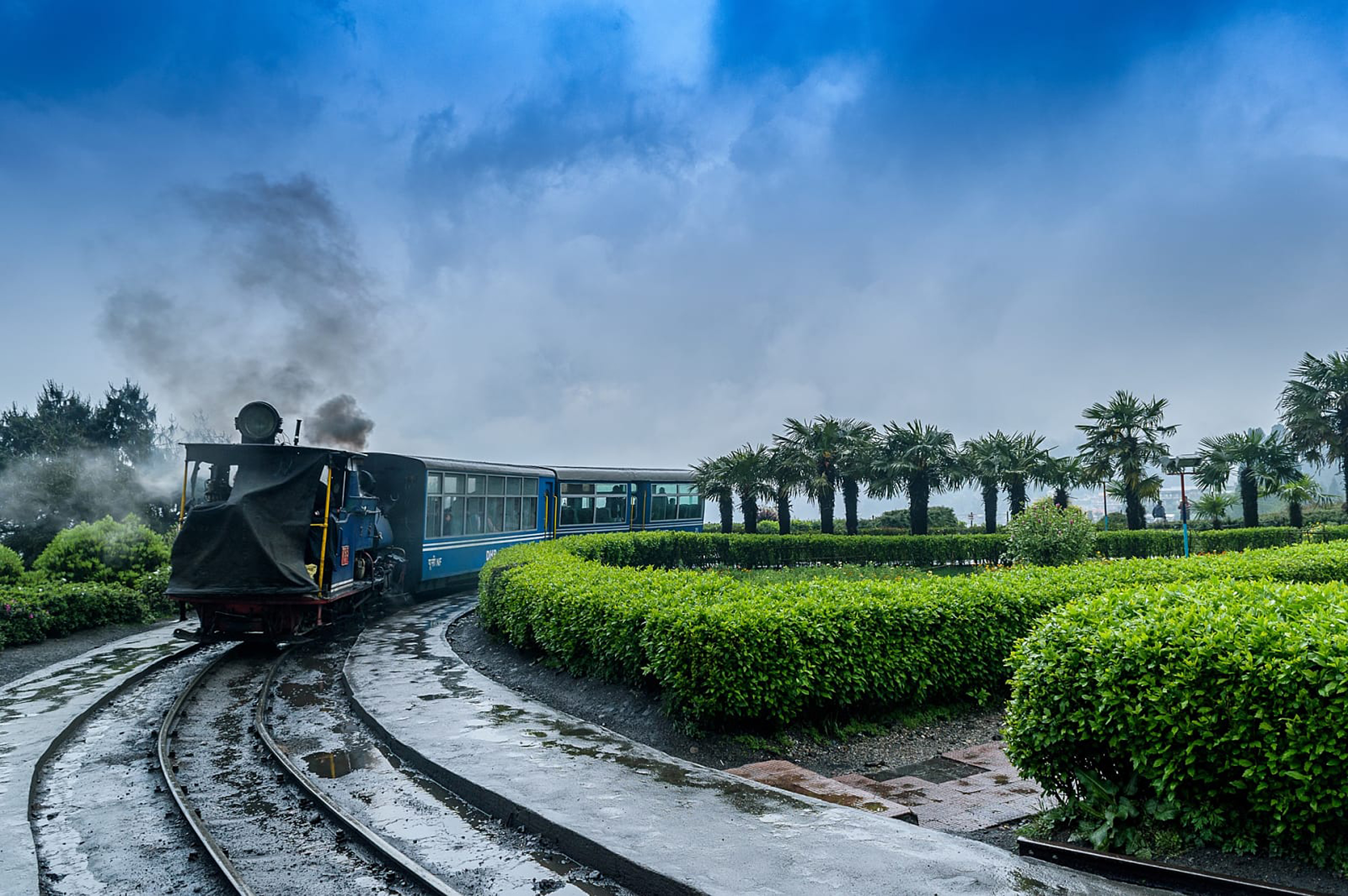
Gangtok & Darjeeling , Sikkim
Nearest Airport : Siliguri Distance from Nearest Airport : 90km Gangtok is a city, municipality, the capital and the largest town of the Indian state of Sikkim. It also is the headquarters of the East Sikkim district. Gangtok is located in the eastern Himalayan range, at an elevation of 1,650 m (5,410 ft). The town's population of 100,000 are from different ethnicities such as Nepalis, Lepchas and Bhutia. Darjeeling is a city and a municipality in the Indian state of West Bengal. It is located in the Lesser Himalayas at an elevation of 6,700 ft (2,042.2 m). It is noted for its tea industry, its views of Kangchenjunga, the world's third-highest mountain, and the Darjeeling Himalayan Railway, a UNESCO World Heritage Site. Darjeeling is the headquarters of the Darjeeling District which has a partially autonomous status within the state of West Bengal. It is also a popular tourist destination in India.
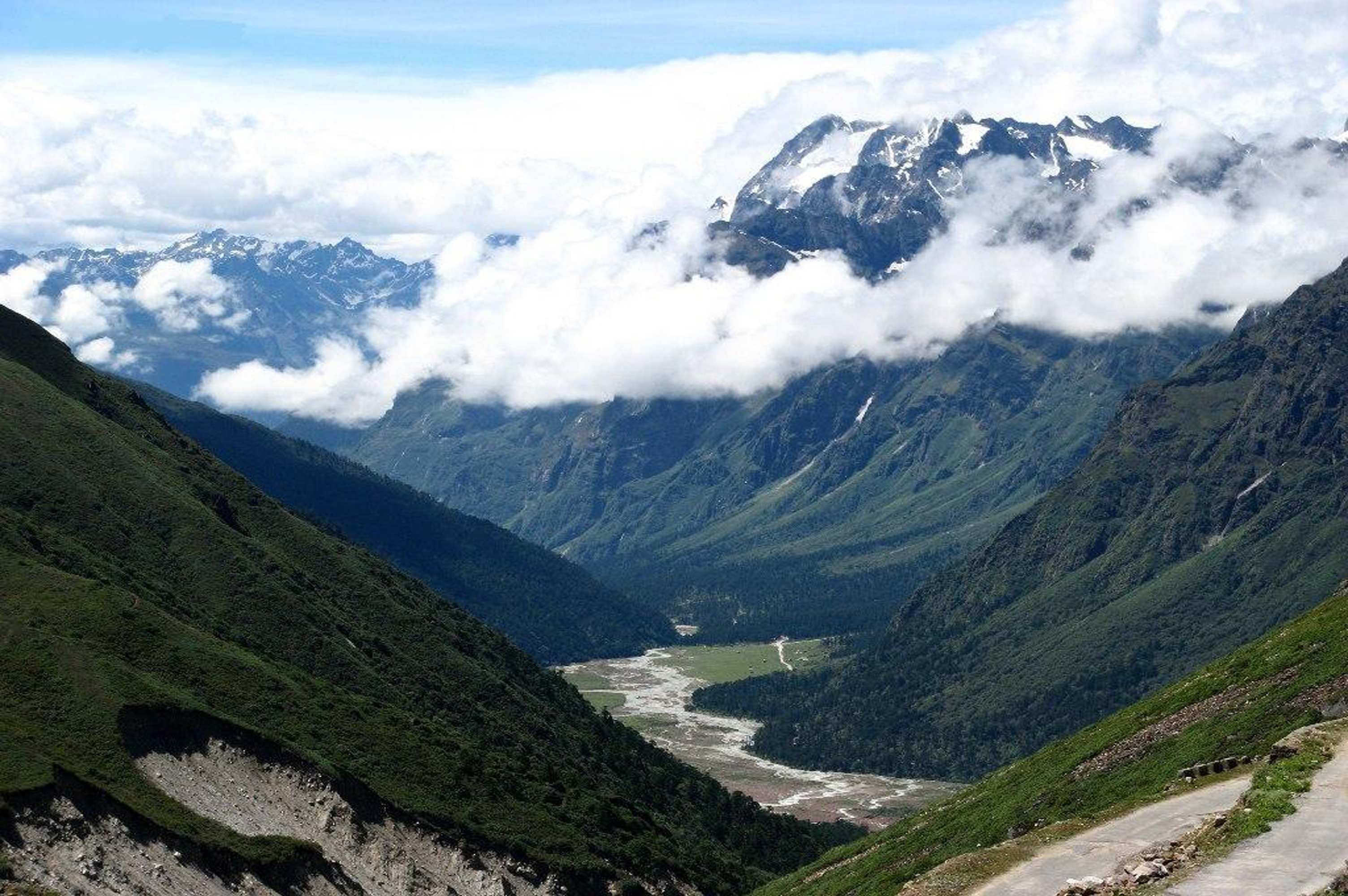
Yumthang Valley, Sikkim
Nearest Airport : Siliguri Distance from Nearest Airport : 212km The Yumthang Valley or Sikkim Valley of Flowers sanctuary, is a nature sanctuary with river, hot springs, yaks and grazing pasture on rolling meadows surrounded by the Himalayan mountains in the North Sikkim district of Sikkim state in India. It is at an elevation of 3,564 metres (11,693 ft) above msl at a distance of 150 kilometres (93 mi) from the state capital Gangtok
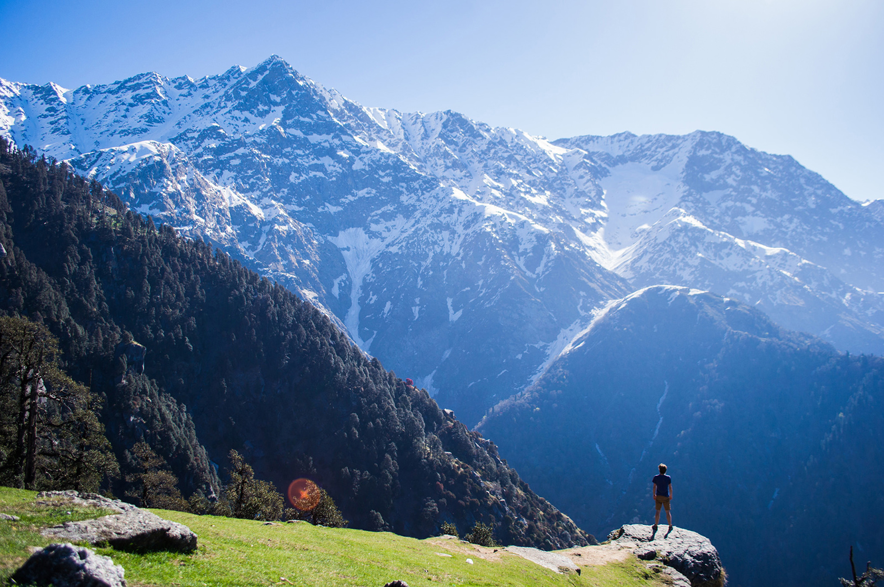
Dharamshala
Nearest Airport : Dharamshala Distance from Nearest Airport : 212km Dharamshala has an average elevation of 1,457 metres (4,780 ft), covering an area of almost 8.51 km2 (3.29 sq mi).Dharamsala is located in the Kangra Valley, in the shadow of the Dhauladhar mountains.The city is divided into two distinct sections. Kotwali Bazaar and the surrounding markets are referred to as "Lower Dharamshala" or just "Dharamshala." Further up the mountain is McLeod Ganj. A steep, narrow road connects McLeod Ganj from Dharamshala and is only accessible to taxis and small cars, while a longer road winds around the valley for use by buses and trucks. McLeod Ganj is surrounded by pine, Himalayan oak, and rhododendron.